
What wildlife tells us about forest carbon projects
 Written by Will Linnell
Veröffentlicht 14 Oktober 2026
5 MIN READ
Written by Will Linnell
Veröffentlicht 14 Oktober 2026
5 MIN READ
From a rare bird spotted in Sabah, to nesting colonies establishing in Sierra Leone and water flowing through tidal channels in Mexico, wildlife can tell us a lot about the status of forest carbon project.
The song of the Bornean Bristlehead carries through the rainforest canopy in Sabah. The bird is rarely seen and lives only on Borneo, where it depends on the forest for shelter and for the insects it feeds on. Its call offers a small glimpse of the forest around it.
Wildlife is a useful way to look inside a forest carbon project. Animals pollinate plants, spread seeds and move nutrients around. Where they turn up, and whether they keep turning up, can indicate whether a forest still offers enough food, shelter, water and places to breed.
A single sighting is a snapshot. Patterns appear only when someone goes back to the same places, year after year, using the same methods. We get closer to three projects in Borneo, West Africa and Mexico, to see how that work can take very different forms.
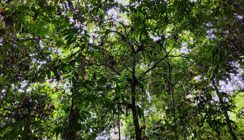
The Sabah INFAPRO Rainforest IFM project is rehabilitating rainforest in Malaysia damaged by logging in the 1980s.
Listening to a recovering rainforest
In 1992, the Sabah INFAPRO Rainforest Rehabilitation Project began work in a rainforest damaged by logging. The site lies in Ulu Segama Forest Reserve in eastern Sabah, next to the Danum Valley Conservation Area. Logging in the 1980s had removed many of the most valuable trees and damaged the forest around them. Since 2013, the wider reserve has been protected from logging as a Class I Protected Forest Reserve.
Project teams collect seeds, raise seedlings locally and plant them into gaps in the damaged forest, a method known as enrichment planting. They also tend the young trees that regenerate naturally. Many of the seedlings are dipterocarps, the giants of Borneo's rainforests, which can grow to exceptional heights, form the upper layers of the canopy and store large amounts of carbon as they mature. Wild fruit trees are planted too, as food for wildlife.
The project covers more than 25,000 hectares, with nearly 400 permanent monitoring plots that track how the forest changes from one verification to the next. In the early years after planting, fast-growing pioneer plants dominate. Over decades, the dipterocarps rise through them to form the long-lived canopy. This is restoration measured in decades rather than seasons.
The project also sits within a much larger block of forest. Orangutans, gibbons, Bornean pygmy elephants and sun bears are found in the wider area, and the project connects with surrounding forest, including Danum Valley, giving animals a larger area to move through.
Listening stations within the project area record birdsong and identify the species they detect, among them the Bornean Bristlehead. Press play and the forest stops being a patch of green on a map. It becomes a place full of distinct voices.
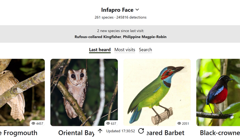
Listening stations within the project area identify birds recorded in the rainforest, including the Bornean Bristlehead.
Listen to the birds of the Sabah rainforest.
Sound is also becoming an important source of ecological data. Research in tropical forests recovering from agricultural use has shown that automated recorders can track changes in biodiversity over time. For Sabah, that kind of insight would depend on recordings gathered consistently over many years.
For now, the Bristlehead's call is one note in a forest shaped by more than three decades of planting, protection and patient work.
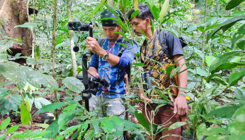
Wildlife monitoring combines field surveys, camera traps, ranger patrols and bird counts.
Following wildlife through time.
In Sierra Leone's Gola Rainforest, the priority is different: protecting forest that is still standing, and following its wildlife over time.
Gola is part of the Upper Guinea Forest, a region rich in wildlife that has lost much of its forest cover. The Gola REDD+ project protects rainforest in and around Gola Rainforest National Park, and its carbon credits come from keeping that forest standing. The same forest is habitat for some of West Africa's most threatened species.
One of Gola's most remarkable residents is the White-necked Picathartes, a long-legged bird with a bare yellow head. It builds mud nests on sheltered rock faces, often under overhangs or inside caves. Because it depends on particular nesting sites, its colonies are good places to return to.
Repeated surveys have found active nests across the monitored colonies, including community forest sites that the birds have recolonized. Other sites have been abandoned. Both findings help teams see where conditions remain suitable and where to look more closely.
Bird monitoring shows a broadly stable overall picture, even as individual species and areas follow their own patterns. In a region that has lost so much forest, the continued presence of these species, and of their habitat, is itself significant.
Community-based Species Champions record threatened wildlife and act as conservation ambassadors, adding local knowledge to the project's monitoring.
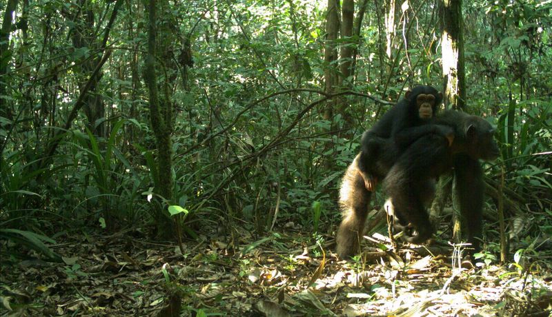
Camera traps help record species that can be difficult to observe directly in Gola’s dense rainforest, including Primates.
Where forests meet water.
In Tabasco, on Mexico's Gulf coast, it's hard to say where the forest ends and the water begins.
Mangroves grow where fresh water meets the tide. Their tangled roots slow the water and trap sediment, creating habitat above and below the surface. They store carbon in their trees and in the waterlogged soil beneath them, which is why they're known as blue carbon ecosystems.
The Tabasco Mangrove Restoration Project restores and protects community-owned mangrove forest. Local ejidatarios, members of the communal landholding groups, are directly involved in the work. They plant native red and white mangroves, clear and maintain channels, prevent fires, patrol the forest and run environmental education.
Restoring a mangrove takes more than planting. Water has to move through the forest, carrying sediment and nutrients and creating the conditions young mangroves need to establish. Blocked or altered channels change conditions across a whole site, so reopening and maintaining them is central to the project's work.
This is a two way relationship. Water flow is essential for the mangroves and the mangroves help manager the water flow - filtering water, reducing erosion and buffering the shoreline. And the mangroves are a haven for wildlife. They shelter young fish and crustaceans while, birds feed and roost in the canopy. Through channel restoration species move between rivers, wetlands, lagoons and the open coast. Restoring the flow of water is the precondition for all of it.
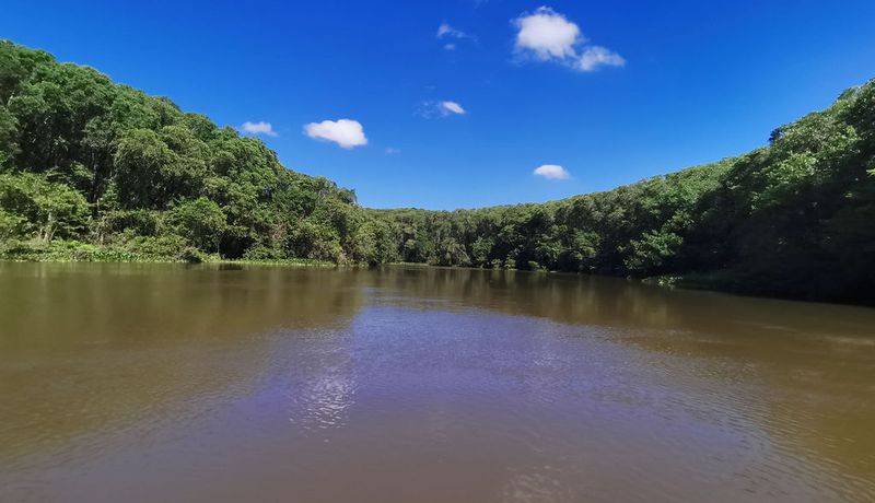
Restoring water flow through mangrove channels is central to the Tabasco project’s work.
Reading the signals
Each project produces a different kind of evidence: a bird call from the canopy, an active nest on a rock face, a camera-trap image from a forest trail, water moving again through a mangrove channel. Each observation reveals only part of the picture. Read alongside what is happening to the trees, water and soil, these observations begin to show how a forest is changing.
That understanding takes years to build. It depends on people returning to the same plots, colonies and channels long after the first trees go in. Carbon finance provides long-term support for the planting, protection, restoration and monitoring that these projects undertake.
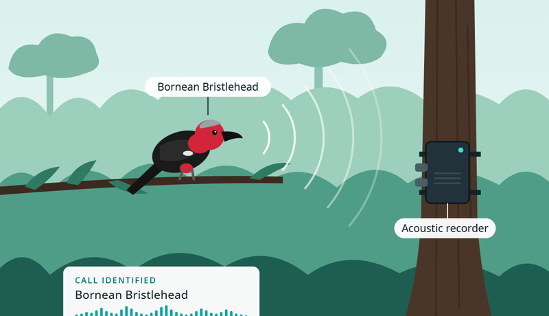
Listening: From birdsong in the canopy to the wider soundscape, audio recordings offer a window into life within the forest.
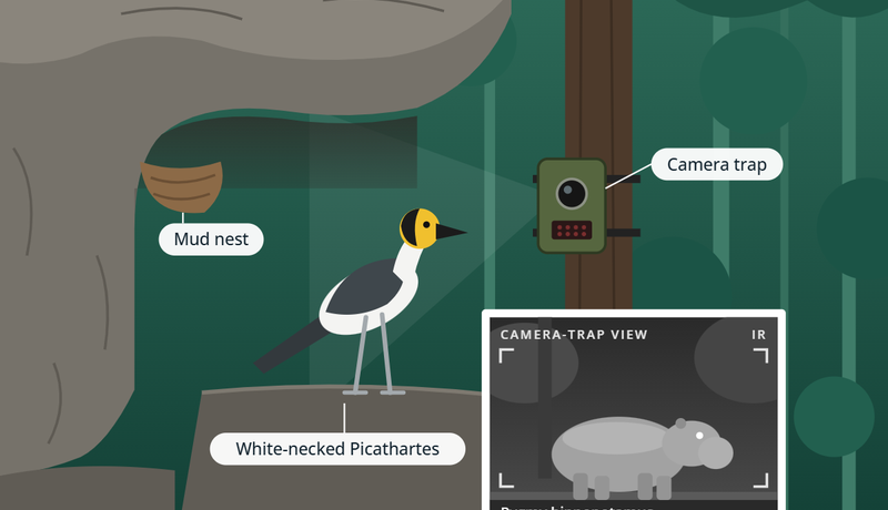
Watching: Camera traps, nest surveys and field observations reveal how wildlife moves through a landscape over time.
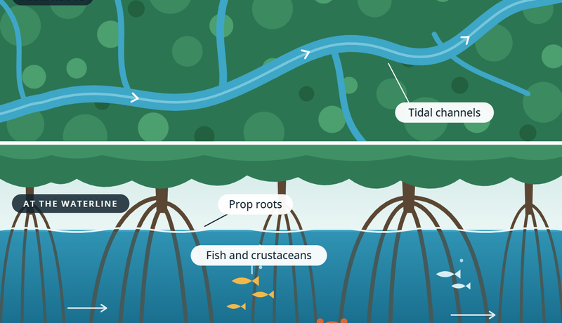
Reading the landscape: Habitat, water and vegetation help explain why species are found where they are, and how ecosystems change.
In Sabah, the call of a Bornean Bristlehead carries through a forest shaped by more than three decades of restoration, a small but immediate sign of the life this recovering landscape supports.
The ways we understand biodiversity are continuing to evolve. Satellite and remote-sensing data can track changes in forest cover across whole landscapes, while environmental DNA can detect signs of species from genetic material left behind in soil or water. Used alongside field surveys, camera traps and acoustic monitoring, these approaches could offer an increasingly detailed view of how ecosystems respond over time
For Climate Impact Partners, staying close to projects means working with project teams and technical specialists to understand the evidence behind their impact, and how new monitoring approaches can strengthen that picture.